Beginning May 29, audiences to Disney/Pixar’s motion picture Up will be treated to yet another of the Emeryville, CA animation studio’s breathtaking visions: a fantastic South American world of towering waterfalls; vast, aircraft carrier-flat mesas called tepuis; and immense hangar-like caves.
In Up, elderly Carl Frederikson (voiced by Ed Asner) strings up a massive array of balloons to loft his house on a quest to find his boyhood hero, presumed lost in the jungles of South America. In a nod to Sir Arthur Conan Doyle’s The Lost World, the centerpiece of the story is Paradise Falls, a legendary waterfall which cascades a staggering 9700 feet from cloud-enshrouded cliffs to the jungle below.
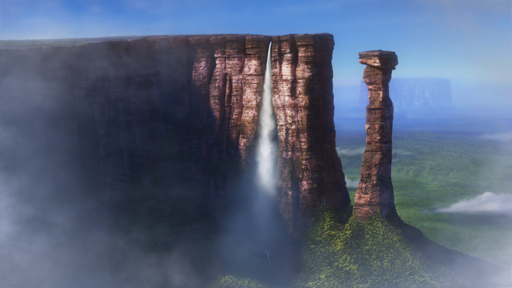 Although Paradise Falls doesn’t exist, Up‘s directors did visit real world locations in South America to model their fictional waterfall. Guided by Adrian Warren, director of the 2003 PBS documentary The Living Edens: The Lost World Tepuis, director Pete Docter and a select group of artists visited Canaima National Park in Venezuela to witness the tepuis firsthand, and to collect the sketches, photographs, and video that would later be used by art and technical directors as reference in creating their own “Lost World.”
In South America, the peculiar mesas depicted in Up are called tepui, or “house of the gods” in the language of the local Pémon. Geologically speaking, the tepuis are all that remains of a vast block of sandstone (known to geologists as the Pacaraima Plateau) that formed 1.8 billion years ago, when the continental basement rock (which geologists refer to as the Amazon Craton) was successively inundated over some 200 million years by a series lakes and seas. Where exposed, the bedrocks of the Amazon Craton are called the Guiana Shield. At over 2 billion years old, the Guiana Shield is oldest rock in South America, and among some of the oldest rocks in the world.
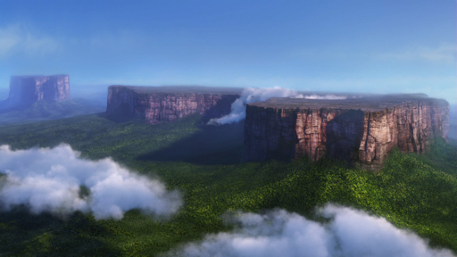 When South America and Africa separated during the formation of the Atlantic Ocean some 180 million years ago, the entire region was uplifted for good and became what is known as the Guyana Highlands. However, under the stress of the uplift, the Pacaraima was broken up, and the forces of erosion began to take its toll on the exposed rock. Only the most-resistant columns of rock survived the onslaught of wind and water, leaving behind the distinctive sheer cliffs of sandstone rising from piles of eroded talus debris.
To get a feel for the sheer scale of the tepuis, the Pixar team visited 3 of the most famous tepui: Mount Roraima, next-door Kukenan, and Auyantepui. At the eastern end of the Canaima National Park, Mount Roraima lies on the intersection of 3 country borders: Brazil, Guyana, and Venezuela. At 2810m tall, it is the tallest of the tepuis and the most famous, having inspired Doyle’s The Lost World. Despite its height, a ramp-like feature called the Roraima Ramp makes it relatively scalable.
 That doesn’t mean it’s a walk in the park, according to Up co-director/writer Bob Peterson:
“It was like your worst nightmare,” says Peterson. “It was like a six- or seven- hour climb to the top, and I had on way too much gear. When we got to the top, we had to hike across uneven terrain for another hour and a half. It was already dark when we got to our camp. And suddenly, from out of the darkness we saw this cave lit by candles and there was warm soup waiting for us. We we saw our tents, most of us just sat down and started crying. We were so happy to be there.”
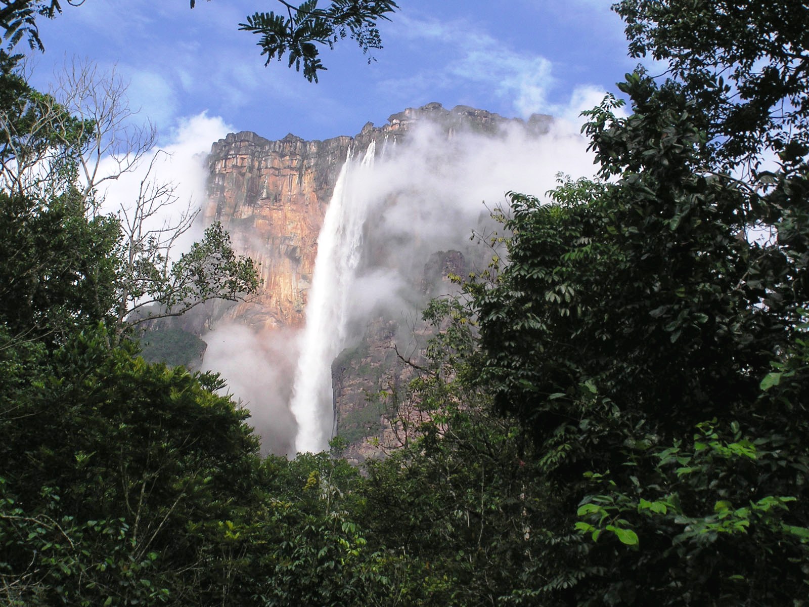
At the western end of the park lies the great Auyantepui, (“House of the Devil”), the largest of the tepuis and home to Angel Falls. Angel Falls is the tallest waterfall on earth at 979m with a clear drop of 807m. If you study a map of Auyantepi, you might notice the falls drain into the river Kerep at its base, but there appears to be no corresponding stream at the summit. How can this happen?
Quick meteorology lesson: as moisture from the ocean and surrounding jungle tries to climb up the 2460m tepui, it cools and condenses into the characteristic cloud layers that enshroud most tepuis. A constant stream of tropical moisture means the tepuis are more often than not covered by clouds and mist. Moisture squeezed from the clouds collects at the 700 km2 summit of Auyantepui and while some of it will trickle through fissures in the sandstone, a significant remainder cascades off the cliff to form the magnificent Angel Falls.
 While Angel Falls may seem like a heavenly name countering a sinister-sounding indigenous one, in reality, Angel Falls was actually named for pilot Jimmy Angel. While searching in 1937 for an amazing waterfall he originally spotted in 1933, Angel managed to crash-land on the summit of Auyantepui. He and his party had to walk for 11 days before finding help. The ensuing publicity surrounding his miraculous rescue prompted the Venezuelan government to name the falls after him. His airplane “El Rio Caroni” was ultimately retrieved in 1970 and now sits on display at the Ciudad Bolivar airport.
As you might expect, having a lot of really flat, wide mountains hovering 1000m above the surrounding terrain might make for some interesting flora and fauna, and you’d be right. The flora of the tepuis are distinct from the Amazonian rain forests and savannahs that surround them and is called the Panepui floristic province. There are 4 major vegetative zones associated with a tepui: the base, the talus, the base of the escarpment, and the summit. Each zone has a unique set of flora adapted to survive in the particular soil type and microclimate. Each tepui has its own set of flora.
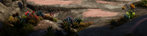
At the summit things can get really interesting. Since the soils are so poor and acidic, and sunlight can be intermittent, insectivorous plants have evolved to adapt to the conditions. Among them are Drosera Roraimae, a type of sundew that capture insects with sticky gobs, and Utricularia humboldtii, a type of bladderwort that captures its prey in a special water-filled bladder.
Look closely in Up, and you’ll likely spot Stegolepis, Orectantes, and Aphanocarpus, and dozens more.
 Due to this rich diversity of life, in 1962 Venezuela designated a significant sector of the state of Bolivar to become a new Parque Nacional Canaima. In 1975, the park was extended to encompass the surrounding Gran Sabana. In 1994, the Canaima National Park and its tepuis were designated a UN World Heritage Site.


Comments on this entry are closed.
{ 28 trackbacks }